Dock as First Responder
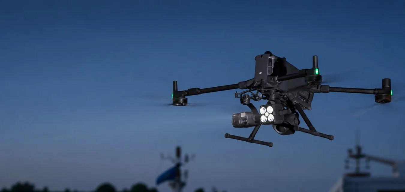
Launch on alarm — first on scene. Drones have become part of an always-ready, dock-based response infrastructure. With pre-deployed DJI Dock 3 units and FlightHub 2 Auto Dispatch, the Dock as First Responder (DFR) solution delivers critical aerial information to an incident 1 km away in under 100 seconds.
Challenges
- Traditional drone-as-first-responder programs still depend on a pilot to launch the drone.
Benefits
- See the scene sooner: the dock launches the drone immediately and streams video to the command center before crews arrive — location, risks and what is happening on site.
- Know before you go in: personnel arrive with an understanding of the situation — the drone helps assess hazards, blind spots and movement before staff enter the scene.
- Send the right resources: verifying the situation before dispatching additional resources helps reduce false calls, coordinate the response and lower the cost of each call.
Equipment and Software
Situational Awareness
Get aerial insight into an evolving situation: high-quality real-time imagery supports ground teams and helps decision-making.
Challenges
- Traditional aerial support such as helicopters is limited and expensive, and ground teams have to cover large areas.
- A lack of complete mission information exposes ground teams to unnecessary risk.
- Information is fragmented between ground teams and the command center, reducing response efficiency and mission success.
Benefits
- Timely and affordable aerial support for patrol and tactical teams.
- Visible and thermal drone data removes uncertainty, reveals hidden hazards and helps de-escalate situations.
- Coordination of team positions and tactical deployment thanks to convenient drone video streaming.
Equipment and Software
Collision Reconstruction and Forensics
Clear roads faster with efficient and accurate drone data collection and reconstruction. Keep officers safe and take forensic work digital.
Challenges
- Manual reconstruction increases risk to forensic personnel.
- Long reconstruction and delays in clearing the road severely affect traffic.
- Incomplete data collection and the lack of realistic visual representation complicate court cases.
Benefits
- Data collection from a safe distance without loss of quality and without unnecessary risk to personnel.
- Significantly reduced data collection time: traffic is restored faster with minimal impact.
- Realistic scene models that can be used at every stage of legal proceedings.
Equipment and Software
Urban Fires
Tackle urban fires with thermal drone data: locate hotspots and allocate resources more effectively.
Challenges
- Firefighters often know little about the complexity of the situation before entering a building.
- Information sharing between fire crews is often inefficient, hindering firefighting and early containment.
- Main hotspots can be hidden under debris, smoke or flames, making them hard to detect and extinguish.
Benefits
- Real-time assessment of incident severity and directing crews to the main hotspots.
- Aerial fire monitoring with a thermal camera for better coordination and crew placement.
- Drone thermal imaging finds different hotspots and shows their temperature.
Equipment and Software
Wildfires
Improve wildfire response with critical aerial information. Locate hotspots more accurately, improve firefighter safety and allocate resources strategically.
Challenges
- The rapid spread and unpredictability of wildfires prevent ground teams from assessing the situation in real time and making accurate decisions.
- Firefighters are exposed to great risk due to limited situational understanding.
- A lack of information prevents the incident commander from allocating resources effectively and tracking the results of actions taken.
Benefits
- Real-time aerial information helps firefighters make informed strategic decisions.
- Better situational understanding improves personnel safety and reduces exposure to hidden hazards.
- Collection of critical data for optimal resource allocation and real-time monitoring of firefighting results.
Equipment and Software
Additional Response
Expand your capabilities — hazardous material leaks, water rescue and other unexpected situations — with multi-purpose aerial support.
Challenges
- Firefighters often lack the people and equipment to properly assess risks during hazardous material leaks.
- Water rescues are usually led by ground teams with limited resources and information.
- Fire prevention requires a lot of manual work: teams search for fire-prone areas on foot.
Benefits
- Critical situational information and high-quality data improve response efficiency.
- A quick aerial view and real-time monitoring make water rescue more effective.
- Coverage of large areas, informed decisions and efficient resource allocation thanks to accurate aerial data.
Equipment and Software
Disaster Response
Use drones to collect critical visible and thermal data: improve prevention and response to natural disasters such as floods, landslides, earthquakes and more.
Challenges
- A lack of up-to-date terrain and situational data seriously hinders an effective response.
- Without real-time information, rescuers enter the disaster zone without seeing how the situation is changing.
- Traditional data collection methods during disaster recovery cannot assess the full extent of damage or determine required resources.
Benefits
- Terrain analysis and situational understanding thanks to up-to-date digital models and real-time aerial imaging.
- Continuous aerial support ensures rescuer safety and proper deployment.
- Complete impact assessment and faster recovery with accurate, easily shared digital models.
Equipment and Software
Search and rescue operations
Support search and rescue operations quickly: cover large and difficult terrain, while aerial thermal imaging helps find missing people.
Challenges
- Rescue operations often take place across large and challenging areas, limiting ground search capabilities.
- A lack of precise coordinates and visual references reduces operational efficiency.
- In some conditions and terrains, a missing person is hard to find through visual search from the ground.
Benefits
- Drone search covers large areas more efficiently.
- Precise coordinates and visual references for ground teams improve rescue efficiency.
- Aerial search by heat signature helps overcome terrain and visibility limitations.
Equipment and Software
Site security
Quickly patrol large areas, identify potential threats and support ground teams with better situational understanding.
Challenges
- Fixed security systems may have limited coverage and blind spots, reducing their effectiveness.
- When an alarm is triggered or a breach occurs, security has to travel to the site to assess the situation, which reduces overall efficiency.
- Intruders may be prepared for security actions, putting staff in unexpectedly dangerous situations.
Benefits
- A complete picture of the perimeter and patrol areas from above — in the visible and thermal spectrum.
- Rapid assessment of the situation and its severity and more efficient dispatch of security teams.
- Real-time aerial data reduces risk to personnel and supports decision-making.
Equipment and Software
Wildlife Protection
Wildlife monitoring and protection are important but challenging tasks. Drones make monitoring more efficient: they quickly cover large areas and find targets using high-resolution zoom cameras and thermal imagers.
Challenges
- Teams often have to cover large areas on foot, which limits daily coverage.
- Moving through difficult terrain while tracking animals is dangerous for staff.
- Traditional monitoring methods rely on manual records, making knowledge transfer difficult.
- Animals may hide when people approach, making them harder to find and observe.
Benefits
- Fast aerial survey of large areas.
- Staff safety in difficult terrain: the drone searches for animals, so foot patrols are not needed.
- Digital records of individual animals and habitat changes that are easy to store and share.
- Thermal and zoom cameras make it possible to observe animals without disturbing their natural behavior.
Equipment and Software