Almaty info@dji.pro Mon–Sat 09:00–18:00

DJI Dock 4

DJI's first dock with automatic battery swapping in under 25 seconds — for 24/7 remote operations with the DJI Matrice 5TD drone. Up to 59 minutes of flight, operating radius up to 10 km, IP56 protection and operation from -40°C to 50°C. Missions and live streams via DJI FlightHub 2 without a pilot on site.

Before operating the drone, please read the information for UAS operators. Learn more ›

Description

DJI Dock 4 — DJI's first dock with automatic battery swapping. The swap takes under 25 seconds, and the drone can take off again less than 45 seconds after landing — without a 30-minute wait for charging. This enables 24/7 continuous missions: incident response, site security, inspection and facility monitoring.

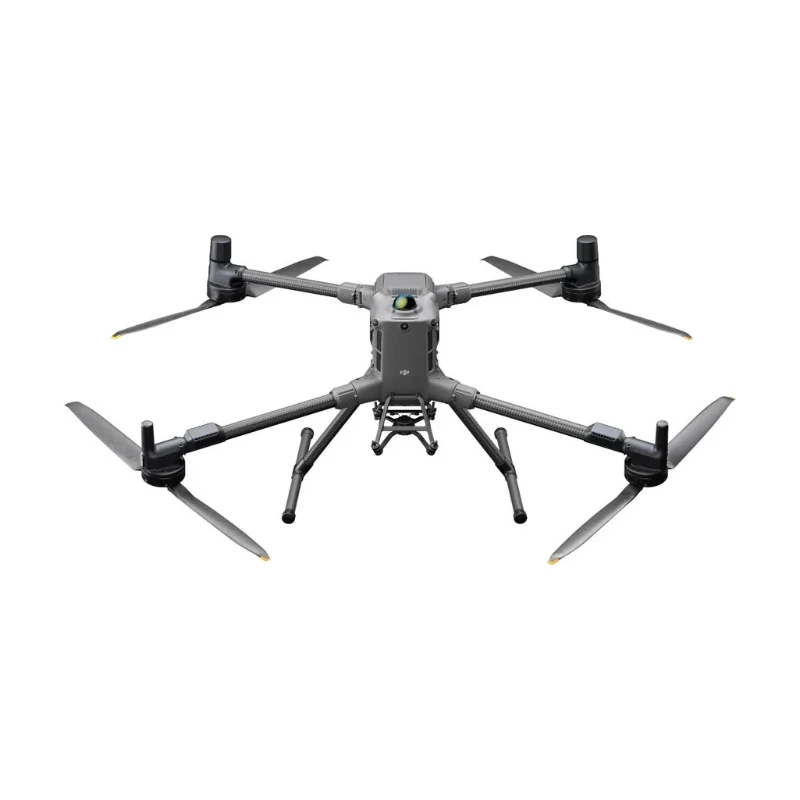
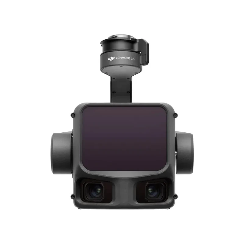
The dock works with the DJI Matrice 5TD drone: up to 59 minutes of flight, operating radius up to 10 km, three 50 MP cameras with up to 176× hybrid zoom, a 1280 × 1024 thermal camera and a laser rangefinder up to 3000 m. A rotating LiDAR, mmWave radars and an omnidirectional vision system provide obstacle detection, including power lines, and onboard AI recognizes 17 object types.

The dock operates from -40°C to 50°C with IP56 protection: it heats batteries in frost and cools with air conditioning in heat. Communication and network connection are provided by the DJI O4 Ground Station, and missions, schedules and live streams are managed via DJI FlightHub 2. Suitable for emergency services, security, energy and industrial enterprises.

Key features

  • Battery swap in under 25 seconds — takeoff again less than 45 seconds after landing.
  • Up to 59 minutes of flight — DJI Matrice 5TD drone with an operating radius of up to 10 km.
  • From -40°C to 50°C — battery heating in frost, air conditioning in heat, IP56 protection.
  • 50 MP cameras and 1280 × 1024 thermal camera — up to 176× hybrid zoom and a laser rangefinder up to 3000 m.
  • Obstacle detection — rotating LiDAR, mmWave radars and omnidirectional vision system.
  • AI recognition — 17 object types in real time.
  • DJI O4 Ground Station — O4 Enterprise Enhanced video transmission and network connection via Ethernet or 4G.

In the box

The DJI Dock 4 configuration is put together individually for your task. It includes:

  • Drone — DJI Matrice 5TD
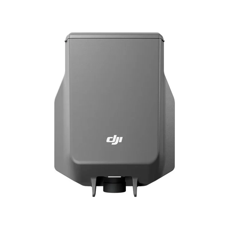
  • DJI O4 Ground Station — required for DJI Dock 4 operation
  • Communication — DJI Cellular Dongle 2 module
  • Additional equipment — DJI AL2D spotlight, DJI AS2D loudspeaker, DJI AP1 parachute, Matrice 5TD Accessory Mount
  • Software — DJI FlightHub 2 or DJI FlightHub 2 On-Premises

To select a configuration, send a request and we will contact you.

Compatible devices

Drones

  • DJI Matrice 5TD — drone with 50 MP cameras, thermal camera, LiDAR and mmWave radars.

Communication and positioning

Drone accessories

  • DJI AL2D, DJI AS2D and DJI AP1 — spotlight, loudspeaker and parachute for Matrice 5TD (installed with the Matrice 5TD Accessory Mount).

Compare with other models ›

Dock - General

Product NameDJI Dock 4
Total Weight66 kg (without batteries in the battery compartment, aircraft not included)The actual product weight may vary due to differences in batch materials and external factors.
DimensionsDock Cover Opened: 1750×640×550 mm (L×W×H)
Dock Cover Closed: 639×640×836 mm (L×W×H)All data includes the wind speed gauge height (145 mm) and mounting base brackets (69 mm).
Input Voltage100-240 V (AC), 50/60 Hz
Input PowerMax 2000 W
Operating Temperature-40° to 50° C (-40° to 122° F)
Ingress Protection RatingIP56
Max Operating Altitude5000 m
Number of Drones Accommodated1
Max Allowable Landing Wind Speed12 m/s
RTK Base StationSupported via DJI O4 Ground Station
Receiving Frequency of RTK Base Station SatelliteSupported via DJI O4 Ground Station

Dock - Charging Performance

Charging MethodBattery Swapping + Wireless Charging
Battery Swap Time< 25 sTime elapsed from when the Dock Cover is fully closed to the completion of the battery swap. Measured in a controlled test environment and is for reference only.
Operational Turnaround Time< 45 sTime elapsed from when the aircraft lands from the previous flight to when it completes the battery swap and takes off again. Measured in a controlled test environment and is for reference only.
Max Number of Batteries Stored Across All Battery Compartments3The dock has four battery compartments, each designed to hold one battery. To ensure proper operation of the battery-swapping mechanism, no more than three of the four compartments may contain a battery at any given time.
Max Number of Parallel Charging Channels2
Output VoltagePer-channel output voltage: 15-25.8 V DC
Charging TimePer-battery charging time: 27 minutesTime required to charge the battery in the battery compartment from 15% to 95% level in a 25° C (77° F) environment.

Dock - Video Transmission

Operating FrequencyHigh-speed Wi-Fi connection:
2.4000-2.4835 GHz: < 23 dBm (IC), < 20 dBm (CE/SRRC/MIC)
5.7250-5.8500 GHz: < 23 dBm (IC/SRRC), < 14 dBm (CE)
DJI O4 Enterprise Enhanced Video Transmission System:
Supported via DJI O4 Ground StationThe supported operating frequency bands and their corresponding availability vary by country/region. For details, please refer to local laws and regulations.
AntennaHigh-speed Wi-Fi connection: Single antenna
DJI O4 Enterprise Enhanced Video Transmission System: Integrated into the O4 Ground Station

Dock - Air Conditioning System

Air Conditioning TypeCompressor-based air conditioning
Operating Voltage48 V DC

Dock - Backup Battery

Backup Power Supply MethodBackup power is supplied by the aircraft battery housed in the dock battery compartment.
Battery Capacity12138 mAh
Output Voltage21.42 V
Battery TypeLiNiMnCoO2
Battery LifeOperating time per battery: approx. 4.5 hours
Supports sequential power supply across three batteriesMeasured in a 25° C (77° F) environment with the backup battery discharged from 90% to 10%. After a power outage, the dock does not support functions like aircraft charging, air conditioning operation, and wind speed gauge heating. Please restore power promptly.

Dock - Network Access

Ethernet AccessSupported (requires connection to DJI O4 Ground Station)
4G AccessRequires use with DJI Cellular Dongle 2 (installed on DJI O4 Ground Station).

Dock - Sensor

Wind Speed SensorSupported
Rainfall SensorSupported
Ambient Temperature SensorSupported
In-Cabin Temperature SensorSupported
In-Cabin Humidity SensorSupported

Dock - Security Camera (External)

Resolution1920×1080
Field of View (FOV)151°
Auxiliary LightAuxiliary White Light

Dock - Security Camera (Internal)

Resolution1920×1080
FOV151°
Auxiliary LightAuxiliary White Light

Dock - Lightning Protection

AC Power Port20 kA (rated value), meets EN 61643-11 Type 2 and IEC 61643-1 Class Ⅱ protection level requirements
Ethernet Port10 kA (Itotal), meets EN/IEC 61643-21 Category C protection level requirements

Dock - Supported Software

ApplicationsDJI Enterprise App (for on-site setup, testing, remote operations, live viewing, and one-tap drone dispatch)
Cloud PlatformFlightHub 2
FlightHub 2 On-Premises Version
FlightHub 2 FlightHub Sync
DJI Cloud API

O4 Ground Station - General

Dimensions170×170×352 mm
Weight2.68 kg
Operating TemperatureDirect connection to DJI Dock power supply: -40° to 55° C (-40° to 131° F)The 55° C (131° F) upper limit accounts for solar radiation. At -40° C (-40° F), the device requires a windless environment; auto-restart after shutdown is not supported in windy conditions. After storage or operation in extreme temperatures, allow the internal backup battery to return to between 0° and 45° C (32° and 113° F) before charging.
PoE Auto Wake-UpWhen connected to the DJI Dock 4 PoE port, the device automatically wakes up when plugged in or when power is restored.
Cold-Weather Heating StartupSupported
Ingress Protection RatingIP67
When the O4 Ground Station is installed close to the dock, use the Ethernet cable included in the package. When it is installed farther away, use the included waterproof Ethernet port connector. The cable must be Cat 6 or above outdoor-rated, waterproof twisted-pair cable with an outer diameter of 5.5 to 6.5 mm. Install the corrugated tubing and corrugated tubing plug, crimp the RJ45 connector, and tighten the connector nut.
Ensure all rubber port covers and the DJI Cellular Dongle 2 heat sink are properly installed. Unused WAN/LAN port screws must be fully tightened.Please follow the requirements stated in the IP67 protection rating instructions. Measured in a controlled environment. The IP rating is not permanently effective and may decrease due to product wear and tear.

O4 Ground Station - GNSS Receiver

GNSS FrequencyGPS: L1C/A, L2C, L5
BDS: B1I, B2I, B3I, B1C, B2a, B2b
GALILEO: E1, E5a, E5b, E6
GLONASS: L1, L2
QZSS: L1C/A, L2C, L5
L-Band
System AccuracyHorizontal: 1.0 cm (RMS) + 1 ppm
Vertical: 3.0 cm (RMS) + 1 ppmRTK calibration is required. Measurement accuracy depends on various factors. This value is obtained under normal conditions with an unobstructed view, good satellite distribution, low ionospheric activity, and no electromagnetic interference or multipath effects.

O4 Ground Station - Video Transmission

Video TransmissionDJI O4 Enterprise Enhanced Video Transmission System
Operating Frequency and Transmitter Power (EIRP)902 MHz to 928 MHz: < 30 dBm (IC), < 16 dBm (MIC)
2.400 GHz to 2.4835 GHz: < 33 dBm (IC), < 20 dBm (CE/SRRC/MIC)
5.150 GHz to 5.250 GHz: < 21 dBm (IC)
5.170 GHz to 5.250 GHz: < 23 dBm (CE)
5.725 GHz to 5.850 GHz: < 33 dBm (IC), < 14 dBm (CE), < 30 dBm (SRRC)Operating frequency allowed varies among countries and regions. Refer to local laws and regulations for more information.
AntennaOcuSync 4 Pro external directional antenna × 4
OcuSync 4 Pro internal directional antenna × 8
2.4G/5.2G/5.8G: 2T4R
sub2G: 2T2R
4G Antenna × 2Operating frequency allowed varies among countries and regions. Refer to local laws and regulations for more information.
Network AccessEthernet Access: Adaptive Ethernet port; Gigabit network is recommended, with both uplink and downlink bandwidth > 20 Mbps, preferably > 40 Mbps (when no other peripherals are connected), and network latency ≤ 100 ms for a better user experience*
4G Access: Requires the DJI Cellular Dongle 2**
** Sold separately. This service is not available in some countries and regions. Please consult your local dealer for details.* If these requirements are not met, the device may go offline or experience video stuttering.

O4 Ground Station - Electrical Properties

Power InterfaceEthernet Port (PoE)
WAN: PoE-in
LAN: PoE-in
Ethernet Cable RequirementsCat 6 or above outdoor-rated, waterproof twisted-pair cable; max length 80 m; outer diameter 5.5 to 6.5 mmTo reduce the risk of waterproofing failure and other reliability issues, use the Ethernet cable included with the DJI Dock for cable runs of less than 5 m from the Dock.
Power Consumption*With DJI Dock 4:
Max Power Consumption (Including Heating): 65 W
Typical Power Consumption (Without Heating): 17.1 W
Low-Power Mode: 7 W**
** Low-power mode is not recommended for use at temperatures of -40° to -20° C (-40° to -4° F).* Measured in a controlled test environment and should be used for reference only. Actual power draw may be higher when accounting for losses in the power supply.
Backup BatteryLi-ion
Capacity: 3250 mAh
Energy: 23.4 Wh
Backup Battery Operating Time (at room temperature)Battery preservation mode is enabled by default when powered via PoE. In the event of a sudden power loss, estimated runtime is 45 minutes.
Battery discharge performance may decrease in low temperatures, reducing actual operating time.Battery preservation mode: when powered via PoE, the system keeps battery voltage between 7.0 V and 7.4 V. If the battery voltage at insertion exceeds 7.5 V, the system will discharge it to the safe threshold before entering preservation mode; the battery will not charge to full capacity.
Backup Battery ChargingSupports 9V or 12V PD charging. DJI 65W Portable Charger is recommended before deployment. When fully charged, estimated runtime is approx. 2 hours.
Charge time (65W PD): approx. 2.5 hours
Charging is only supported when the battery cell temperature is between 0° and 55° C (32° and 131° F).Charging with a 5V charger is only supported when the device is powered off.
Ethernet Port Surge ProtectionWAN/LAN Ports: Ethernet interface supports up to 10 kA (total discharge current) surge protection, meeting EN/IEC 61643-21 Category C.Surge protection capability depends on the capacity and reliability of grounding. To minimize the risk of surges, please make sure that grounding is done properly during installation.

O4 Ground Station - Supported Software

Supported SoftwareDJI Enterprise App (for on-site setup, testing, remote operations, live viewing, and one-tap drone dispatch)
Cloud PlatformFlightHub 2
FlightHub 2 On-Premises Version
FlightHub 2 FlightHub Sync
Third-party cloud platform developed based on DJI Cloud API
External Device SupportSupports cameras using ONVIF and GB/T 28181 protocols
Supports up to 4 simultaneous 1080p H.264 video streamsThe camera and the WAN port of the DJI O4 Ground Station must be connected to the same upstream switch. For details, see the DJI O4 Ground Station - IP Camera Configuration Guide.
Open EcosystemESDK 2.0

Aircraft - General

Product NameDJI Matrice 5TD
Weight2600 gThis value includes the weight of the battery, propellers, and a microSD card, but does not include third-party payloads. The actual weight may vary due to differences in batch materials and external factors.
Max Takeoff Weight3050 g
Dimensions393×477×230 mm (L×W×H, without propellers)
WheelbaseDiagonal Wheelbase: 549 mm
Max Ascent Speed6 m/s
Max Descent Speed6 m/s
Max Horizontal Speed (at sea level, no wind)21 m/sCurrently, only FlyTo Tasks (Fly to a Target Point) support flight speeds of up to 21 m/s. In other modes, the maximum flight speed is 15 m/s.
Max Wind Speed Resistance12 m/s
Max Takeoff Altitude6500 mAircraft without payload.
Max Takeoff Altitude at Full Load4500 m
Max Flight Time59 minutesMeasured under the following conditions: in a windless laboratory environment at 20 meters above sea level, with the aircraft flying forward without payload at a constant speed of 15 m/s from 100% battery level until 0%. Results may vary depending on the environment, actual use, and firmware version.
Max Hovering Time55 minutesMeasured with the aircraft hovering in a windless environment at 20 meters above sea level and from 100% battery level until 0%. Results may vary depending on the environment, actual use, and firmware version.
Max Operating Radius10 kmMeasured in an environment of approximately 25° C (77° F) with a safe battery level of 15%, windless environment, round-trip flight speed of approximately 15 m/s, and hovering operation without payload of 25 minutes. Results may vary depending on the environment, actual use, and firmware version.
Max Flight Distance53 kmMeasured with the aircraft flying at a constant speed of 15 m/s in a windless environment at 20 meters above sea level and from 100% battery level until 0%. Results may vary depending on the environment, actual use, and firmware version.
Max Pitch Angle25°Currently supported in Normal Mode only.
Max Angular Velocity75°/sCurrently supported in Normal Mode only.
Global Navigation Satellite SystemGPS + Galileo + BeiDou + QZSS + GLONASS
Hovering Accuracy Range (windless or breezy)Vertical:
±0.1 m (with vision positioning)
±0.04 m (with RTK positioning)
Horizontal:
±0.3 m (with vision positioning)
±0.02 m (with RTK positioning)
Operating Temperature-40° to 50° C (-40° to 122° F)
Ingress Protection RatingIP55
Motor Model3409.6
Propeller Model1564F foldable low-noise anti-ice propellers
RTK ModuleIntegrated on the aircraft
BeaconIntegrated on the aircraft
Warning LightA customizable multicolor warning light, integrated into the bottom of the aircraft
Accessory Mounting PointsTwo on the sides and one on the topRequires the Matrice 5TD Accessory Mount.

Aircraft - Sensing

Sensing TypeOmnidirectional binocular color vision system; horizontal rotating LiDAR; downward 3D infrared ranging sensor; and forward, upward, and downward mmWave radars
ForwardMeasurement Range: 0.5 m to 25 m
Detection Range: 0.5 m to 200 m
Effective Sensing Speed: Flight Speed ≤ 15 m/s
FOV: Horizontal 95°, Vertical 90°
BackwardMeasurement Range: 0.5 m to 25 m
Effective Sensing Speed: Flight Speed ≤ 15 m/s
FOV: Horizontal 95°, Vertical 90°
LateralMeasurement Range: 0.5 m to 25 m
Effective Sensing Speed: Flight Speed ≤ 15 m/s
FOV: Horizontal 90°, Vertical 90°
UpwardMeasurement Range: 0.5 m to 20 m
Effective Sensing Speed: Flight Speed ≤ 10 m/s
FOV: Front and Back 95°, Left and Right 90°
DownwardMeasurement Range: 0.5 m to 20 m
Effective Sensing Speed: Flight Speed ≤ 8 m/s
FOV: Front and Back 90°, Left and Right 95°
Operating EnvironmentForward, Backward, Left, Right, and Upward: Surfaces with discernible patterns and adequate lighting (lux > 0.1)
Downward: Diffuse reflective surface with discernible patterns, diffuse reflectivity > 20% (e.g. walls, trees, people), and adequate lighting (lux > 0.1)
Rotating LiDARStandard Measurement Range: 110 m @ 100,000 lux with 10% reflectivity target
Measurement Range for Power Line: 32 m @ 30° @ 35,000 lux for 21.6 mm steel-core aluminum stranded wire with a relative body tilt angle of 30° to the left and right
19 m @ 30° @ 35,000 lux for 11 mm black rubber cable (with surface soiling) with a relative body tilt angle of 30° to the left and right
Field of View (FOV): 360° (horizontal), 59° (vertical)
Point-Frequency: 250,000-460,000 points/second
Laser Wavelength: 940 nm
Safety Classification: Class 1 (IEC 60825-1:2014)
Downward 3D Infrared SensorMeasurement Range: 0.3-8 m (reflectivity > 10%)
FOV: Front and Rear 60°, Left and Right 60°
Millimeter-Wave RadarFOV: Vertical 90°, Horizontal 90°
Front Millimeter-Wave Radar: 40 m measurement range for a 12 mm black rubber cable directly ahead
Upper and Lower Millimeter-Wave Radars: 20 m measurement range for a 12 mm black rubber cable directly aheadThe mmWave radar function may be unavailable or restricted in some countries or regions. Refer to local laws and regulations for more information.

Aircraft - Video Transmission

Video Transmission SystemDJI O4 Enterprise Enhanced Video Transmission System
Live View Quality1080p/30fps (with DJI Dock 4)
Video Transmission Transmitter Power (EIRP)DJI O4 Enterprise Enhanced Video Transmission System:
902-928 MHz: < 30 dBm (IC), < 16 dBm (MIC)
1.430-1.444 GHz: < 35 dBm (SRRC)
2.400-2.4835 GHz: < 33 dBm (IC), < 20 dBm (CE/SRRC/MIC)
5.150-5.250 GHz: < 21 dBm (IC)
5.170-5.250 GHz: < 23 dBm (CE)
5.725-5.850 GHz: < 33 dBm (IC), < 14 dBm (CE), < 30 dBm (SRRC)
High-speed Wi-Fi connection (802.11a/b/g/n/ac/ax):
2.4000-2.4835 GHz: < 23 dBm (IC), < 20 dBm (CE/SRRC/MIC)
5.7250-5.8500 GHz: < 23 dBm (IC/SRRC), < 14 dBm (CE)The supported operating frequency bands and their corresponding availability vary by country/region. For details, please refer to local laws and regulations.
Max Transmission Distance (unobstructed, free of interference)IC: 40 km
SRRC: 25 km
CE/MIC: 12 kmMeasured in an unobstructed outdoor environment free of interference. The above data shows the farthest communication range for one-way, non-return flights under each standard. Always pay attention to RTH reminders in DJI FlightHub 2 during your flight.
Max Transmission Distance (unobstructed, with interference)Strong Interference (downtown areas): 2.5-5 km
Medium Interference (suburban counties): 5-15 km
Low Interference (remote suburbs/coastal areas): 15-32 kmData is tested under IC standard in unobstructed environments of typical interference. Only to serve as a reference and provides no guarantee as to the actual flight distance.
Max Transmission Distance (obstructed, with interference)Low interference with building obstruction: approx. 0-1 km
Low interference with vegetation obstruction: approx. 1-5 kmData is tested under IC standard in obstructed environments of typical interference. Only to serve as a reference and provides no guarantee as to the actual flight distance.
Max Download Speed20MB/s (with DJI O4 Enterprise Enhanced Video Transmission System)
80MB/s (via high-speed Wi-Fi connection)Measured in a near-field, interference-free lab in countries/regions that support 2.4 GHz/5.8 GHz dual-band. Download speeds may vary; refer to actual experience. The Wi-Fi high-speed channel download starts automatically after the drone lands at the dock and requires the included SD card. 80 MB/s is the maximum transfer rate for large files like video; the transfer rate may decrease when transferring small files such as photos.
Lowest LatencyThe latency from the aircraft to the FlightHub 2 cloud platform is 160 milliseconds.Data is for reference only. Actual latency depends on network conditions and computer specs.
Antenna8 antennas
2.4G/5.2G/5.8G: 2T4R
sub2G: 2T2ROperating frequency allowed varies among countries and regions. Refer to local laws and regulations for more information.
OthersBuilt-in dual 4G modules
Data usage: ≤ 2.25 GB/30 minutes (dual-SIM dual-active backup transmission)4G is not supported in some countries or regions. Please contact your local dealer for details.

Aircraft - Storage

Supported Memory CardsU3/Class10/V30 or above is supported. A list of recommended microSD cards can be found below.
Recommended microSD CardsLexar SILVER PLUS 64GB U3 A2 V30 microSDXC
Lexar SILVER PLUS 128GB U3 A2 V30 microSDXC
Lexar SILVER PLUS 256GB U3 A2 V30 microSDXC
Lexar SILVER PLUS 512GB U3 A2 V30 microSDXC

Aircraft - Battery

Capacity12138 mAh
Voltage21.42 V
Max Charging Voltage25.8 V
Cell TypeLi-ion 6S
Chemical SystemLiNiMnCoO2
Energy260 Wh
Weight925 g
Cycle Count400Storage at high temperatures will shorten the battery's lifespan. If the cumulative storage duration at temperatures above 35° C (95° F) does not exceed 100 days within a 12-month period, the battery can support up to 400 cycles.
Charging Temperature10° to 55° C (50° to 131° F)
Discharge Rate3C
Max Charging Power1.8C
Low-Temperature ChargingSupports low-temperature self-heating charging

Aircraft - Gimbal

Stabilization3-axis mechanical gimbal (tilt, roll, pan)
Mechanical RangeTilt: -140° to +113°
Roll: -52° to +52°
Pan: -75° to +75°Soft limits: tilt -130° to +90°, roll -47° to +47°, pan -70° to +70°.
Controllable RangeTilt: -90° to +90°
Pan: Not controllable
Angular Vibration Range±0.005°
Max Control Speed (tilt)100°/s

Aircraft - Camera

Image SensorWide-Angle Camera: 1/0.98-inch CMOS, Effective Pixels: 50 MP
Medium Tele Camera: 1/1.28-inch CMOS, Effective Pixels: 50 MP
Tele Camera: 1/1.5-inch CMOS, Effective Pixels: 50 MP
LensWide-Angle Camera
FOV: 85.7°
Format Equivalent: 23.5 mm
Aperture: f/1.8
Focus: 0.6 m to ∞
Medium Tele Camera
FOV: 35°
Format Equivalent: 70 mm
Aperture: f/2.88
Focus: 3 m to ∞
Tele Camera
FOV: 9.7°
Format Equivalent: 252 mm
Aperture: f/2.8
Focus: 5 m to ∞
Lens DefoggingWide-angle, medium tele, and tele cameras all support lens defogging.
ISO RangeNormal Mode: ISO 100 to ISO 25600
Night Scene Mode:
Wide-Angle Camera: ISO 100 to ISO 1638400
Medium Tele Camera: ISO 100 to ISO 1638400
Tele Camera: ISO 100 to ISO 1638400
Shutter SpeedWide-Angle Camera: 2-1/8000 s
Medium Tele Camera: 2-1/8000 s
Tele Camera: 2-1/8000 s
Max Image SizeWide-Angle Camera: 8192×6144
Medium Tele Camera: 8192×6144
Tele Camera: 8192×6144
Minimum Photo Interval0.5 s
Still Photography ModesWide-Angle Camera:
Single: 12 MP / 50 MP
Timed: 12 MP / 50 MP
JPEG: 0.5/0.7/1/2/3/5/7/10/15/20/30/60 s
Smart Capture: 12 MP
Panorama: Approx. 110 MP (stitched image)
Medium Tele Camera:
Single: 12 MP / 50 MP
Timed: 12 MP / 50 MP
JPEG: 0.5/0.7/1/2/3/5/7/10/15/20/30/60 s
Smart Capture: 12 MP
Tele Camera:
Single: 12 MP / 50 MP
Timed: 12 MP / 50 MP
JPEG: 0.5/0.7/1/2/3/5/7/10/15/20/30/60 s
Smart Capture: 12 MP
Video Codec and ResolutionVideo Codec: H.265
Encoding Strategy: CBR, VBR
Resolution:
4K: 3840×2160@30fps
FHD: 1920×1080@30fps
Video BitrateH.265: 40 Mbps
Supported File SystemexFAT
Photo FormatJPEG
Video FormatMP4, TS
Digital ZoomTele Camera:
16× (176× hybrid zoom)

Aircraft - NIR Auxiliary Light

Infrared IlluminationFOV: 5.2° to 6.6°

Aircraft - Laser Module

Laser RangefindingNormal Incidence Range: 3000 m (1 Hz, @25% reflectivity target*, 8000 m visibility)
Oblique Incidence Range: 1200 m (1 Hz, 1:10 Oblique Distance)
Blind Zone: 1 m
Ranging Accuracy: (@ 20%-90% reflectivity, 1-10 Hz)
Systematic Error:
Within 12 m: < 0.1 m
12 m to 100 m: < 0.3 m
100 m to 3000 m: < 1 m
Random Error:
< 0.1 m (1σ)
Safety Classification: Class 1 (IEC 60825-1:2014)* Performance degradation may occur in rainy or foggy conditions.

Aircraft - Infrared Thermal Camera (DJI Matrice 5TD)

Thermal ImagerUncooled VOx MicrobolometerDO NOT expose the infrared camera lenses to strong sources of energy such as the sun, lava, or a laser beam. Otherwise, the camera sensor may be burned, leading to permanent damage.
Resolution1280×1024
Pixel Pitch8 μm
Frame Rate30 Hz
LensDFOV: 45°
Format Equivalent: 53 mm
Aperture: f/0.85
Focus: 10 m to ∞
Sensitivity≤ 50 mK@f/1.0, at an ambient temperature of 25° C (77° F)
Temperature Measurement MethodSpot Measurement, Area Measurement
Temperature Measurement RangeHigh Gain Mode: -40° to 150° C (-40° to 302° F)
Low Gain Mode: 0° to 550° C (32° to 1022° F)
Visible-Thermal FusionSupported
PaletteWhite Hot/Black Hot/Tint/Iron Red/Hot Iron/Arctic/Medical/Fusion/Rainbow 1/Rainbow 2
Photo FormatJPEG (8-bit)
R-JPEG (16-bit)
DLT-664
Video ResolutionUHR Infrared Image Mode: 2560×2048@30fps
Normal Mode: 1280×1024@30fps
Video Bitrate12 Mbps (H.265, 1280×1024@30fps)
24 Mbps (H.265, 2560×2048@30fps)
Video FormatMP4
Still Photography ModesSingle
Normal Mode: 1280×1024
UHR Infrared Image Mode: 2560×2048
Timed
Normal Mode: 1280×1024, 0.7/1/2/3/5/7/10/15/20/30/60 s
UHR Infrared Image Mode: 2560×2048,
0.7/1/2/3/5/7/10/15/20/30/60 s
Digital Zoom32×
Infrared Wavelength8-14 μm
Infrared Temperature Measurement AccuracyHigh Gain: ±2° C or ±2%, whichever is greater
Low Gain: ±5° C or ±3%, whichever is greater
Temperature AlertSupported
Sun Burn ProtectionSupported

AL2D Spotlight

Weight115 g (excluding bracket)
Dimensions91×54×60 mm (L×W×H, excluding bracket)
Max PowerSpotlight: 40 W
Floodlight: 18 W
Both On: 48 W
IlluminanceSpotlight: 11.2±0.5 lux @ 100 meters
Floodlight: 2.7±0.2 lux @ 100 metersThis data was measured with the aircraft hovering in a laboratory environment at an ambient temperature of 25° C (77° F).
Effective Illumination AngleSpotlight: 14.5° (10% center illuminance)
Floodlight: 23° (10% center illuminance)
Effective Illumination AreaSpotlight: 500 square meters @ 100 meters (10% center illuminance)
Floodlight: 1,300 square meters @ 100 meters (10% center illuminance)
Operating ModeAlways-On Mode: Spotlight, Floodlight, Both On, and Auto (automatically switches lighting modes based on the zoom level)
Strobe Mode: Slow, FastWhen the spotlight is turned on, visual obstacle sensing is disabled and only the mmWave radar and LiDAR remain active, reducing omnidirectional obstacle sensing performance. Fly with caution.
Gimbal Mechanical RangeTilt: -135° to +135°
Gimbal Controllable RangeTilt: -90° to +90°
Gimbal Max Control Speed (tilt)120°/s
Gimbal Alignment Accuracy±0.1°
Operating Temperature-40° to 50° C (-40° to 122° F)
Ingress Protection RatingIP55
MountingMounted on the right side of the aircraft using the Matrice 5TD Accessory Mount. Make sure to tighten the mounting screws during installation.

AS2D Loudspeaker

Weight188 g (excluding bracket)
Dimensions132×47×54 mm (L×W×H, excluding bracket)
Max Power30 W
Max Volume120.5 dB @ 1mData measured in a laboratory environment at 25° C (77° F). Actual conditions may vary slightly due to software version, audio source, specific environment, and other factors. The final effect is subject to actual use.
Effective Broadcast Distance400 mData measured in a laboratory environment at 25° C (77° F). Actual conditions may vary slightly due to software version, audio source, specific environment, and other factors. The final effect is subject to actual use.
Broadcast ModeReal-time broadcasting, record & broadcast, file import (supports playback during transfer), text-to-speech
Text-to-Speech LanguageChinese, English, Japanese, Korean, French, Spanish, GermanOnly Chinese and English support both male and female voices; other languages support female voices only.
Operating Temperature-40° to 50° C (-40° to 122° F)
Ingress Protection RatingIP55
MountingMounted on the left side of the aircraft using the Matrice 5TD Accessory Mount. Make sure to tighten the mounting screws during installation.

AP1 Parachute

Weight107 g (excluding bracket)
Dimensions92×70×56 mm (L×W×H, excluding bracket)
Max Supported Takeoff Weight3050 g
Operating Altitude0-5000 m
Stabilized Descent Speed< 6 m/sMeasured in a windless environment at 25° C (77° F), at an altitude between 30 m and 500 m, with DJI Matrice 5TD taking off at the max takeoff weight of 3050 g. Data is for reference only. Actual experience may vary depending on the environment, usage, and firmware version.
Effective Deployment Altitude≥ 35 m
The 35 m data was measured in a windless environment at 25° C (77° F), at an altitude below 500 m, with DJI Matrice 5TD taking off at the max takeoff weight of 3050 g. Data is for reference only. Actual experience may vary depending on the environment, usage, and firmware version.The minimum effective deployment altitude of DJI AP1 Parachute is 35 m (the minimum vertical altitude required for the parachute to stabilize the aircraft's descent below 6 m/s). If deployed below 35 m, the parachute will still eject, but may not fully inflate to adequately slow the descent. Additionally, in some cases, auto-deployment may not trigger, requiring manual operation. Please fly with caution. For detailed features and trigger conditions, visit the official product page.
Automatic Deployment Response Time600 msMeasured in a controlled laboratory environment. With DJI Matrice 5TD hovering and propellers spinning, this is the total time interval recorded from the triggering of the Flight Termination System (FTS) signal, through the confirmation of a complete rotor stop, to the triggering of the gas generator's electrical signal. Data is for reference only. Actual experience may vary depending on the environment, usage, and firmware version.
Deployment MethodManual/Automatic
Operating Temperature-40° to 50° C (-40° to 122° F)
Ingress Protection RatingIP55
MountingMounted on top of the aircraft using the Matrice 5TD Accessory Mount. Make sure to tighten the mounting screws during installation.
Audible and Visual AlarmsAircraft beeping and indicator flashing
Backup Power Duration30 sMeasured at 25° C (77° F) with the parachute in its factory state, or when the parachute is connected to the aircraft for over 10 minutes of flight time each month. Data is for reference only. Actual experience may vary depending on the environment, usage, and firmware version.
Self-CheckContinuously checks the status of the gas generator and communication links, displaying alerts via the DJI FlightHub 2 Health Management System (HMS) interface.
Independent FTS LinkSupported

Matrice 5TD Accessory Mount

Weight40 g
Dimensions117×126×70 mm (L×W×H)
Number of Supported Mounting Points3

Specifications are based on official DJI data (enterprise.dji.com/dock-4/specs). Actual values may vary depending on operating conditions and firmware version.